|
No p/n |
Name historical and cultural value.
Place Location |
Description |
|
1 |
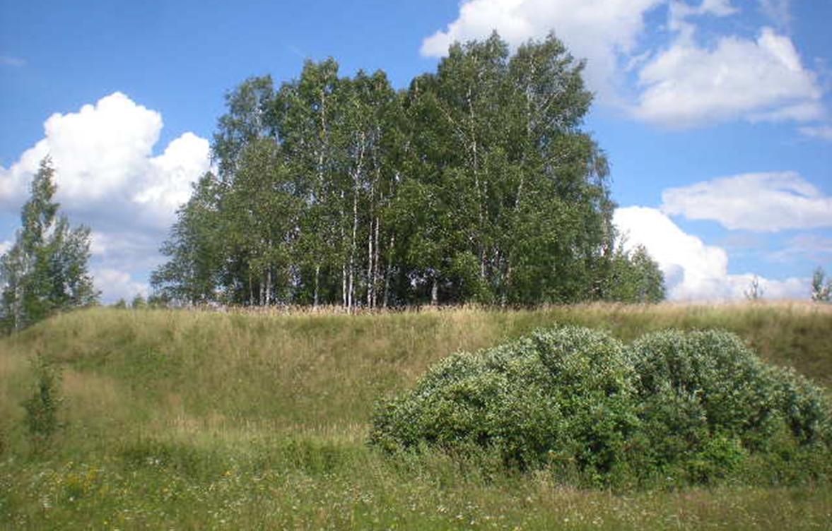
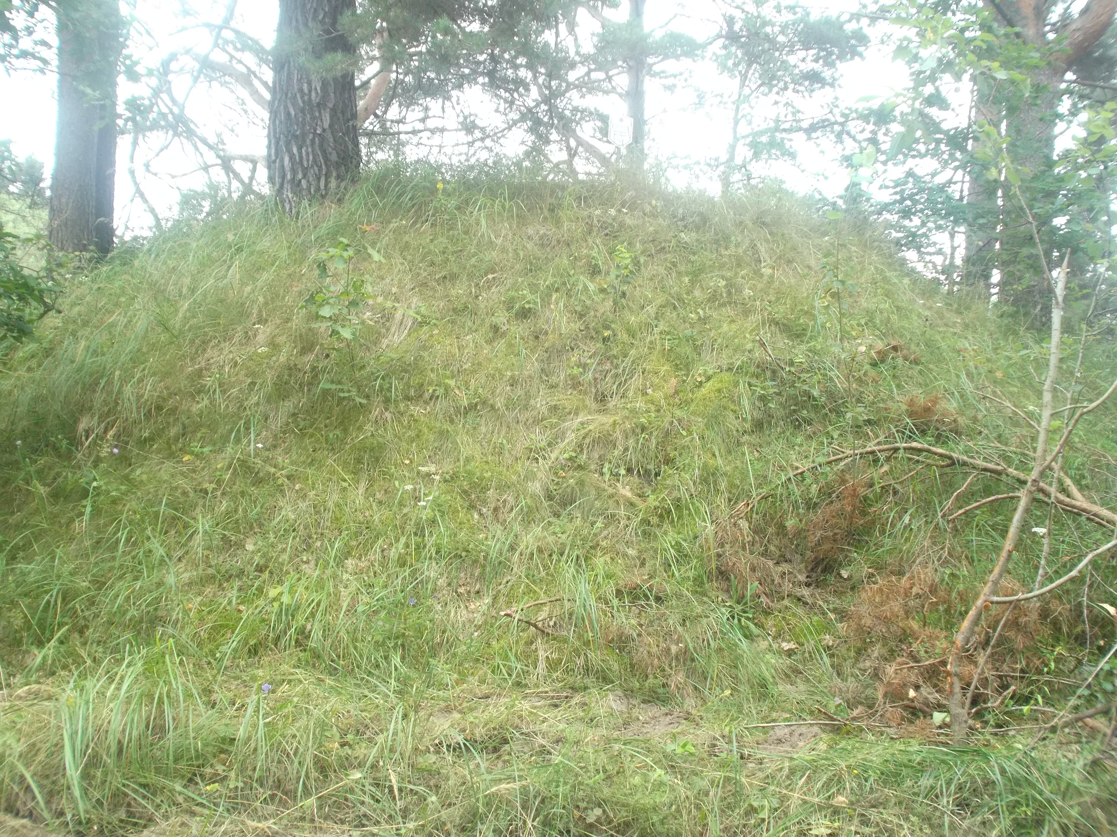
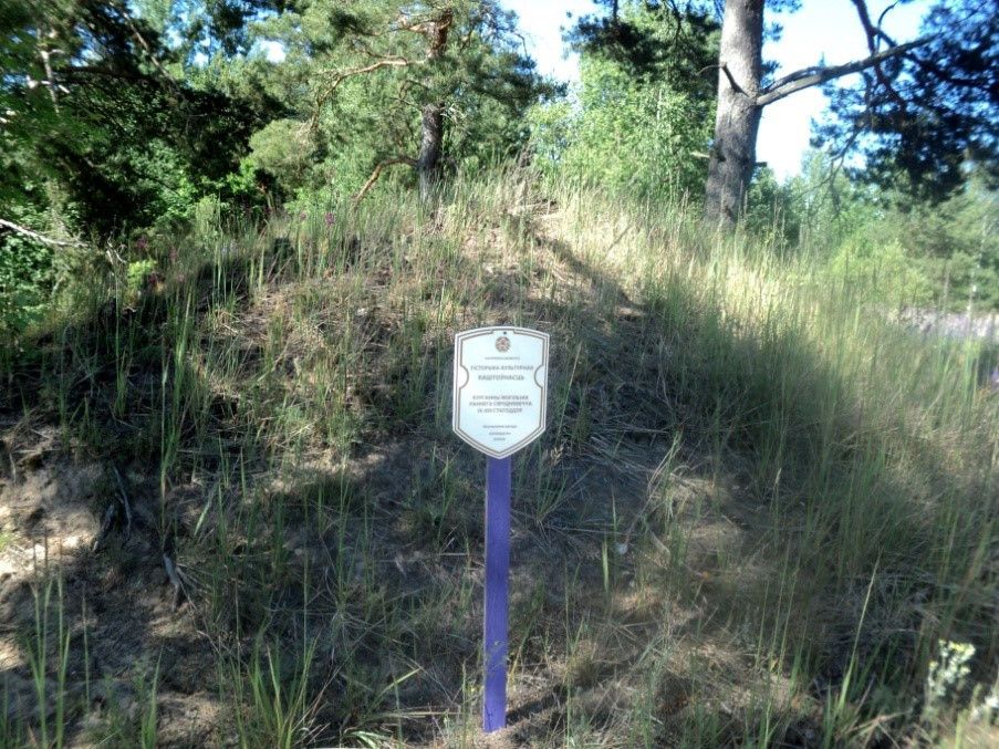
Ancient settlement of the Early Iron Age (V century BC – V century AD)
Gora village, 2 km northwest of Village
|
Early Iron Age Hillfort is located on the shore of Lake Chereyskoye.
The local name of the monument is "Mountain". |
|
2 |
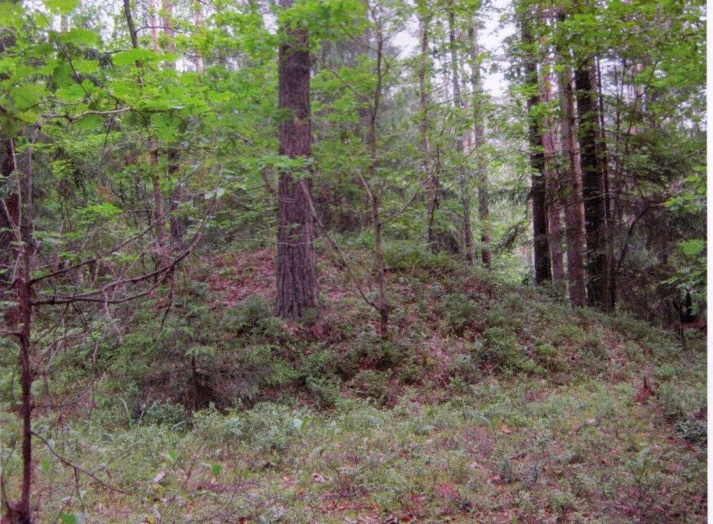
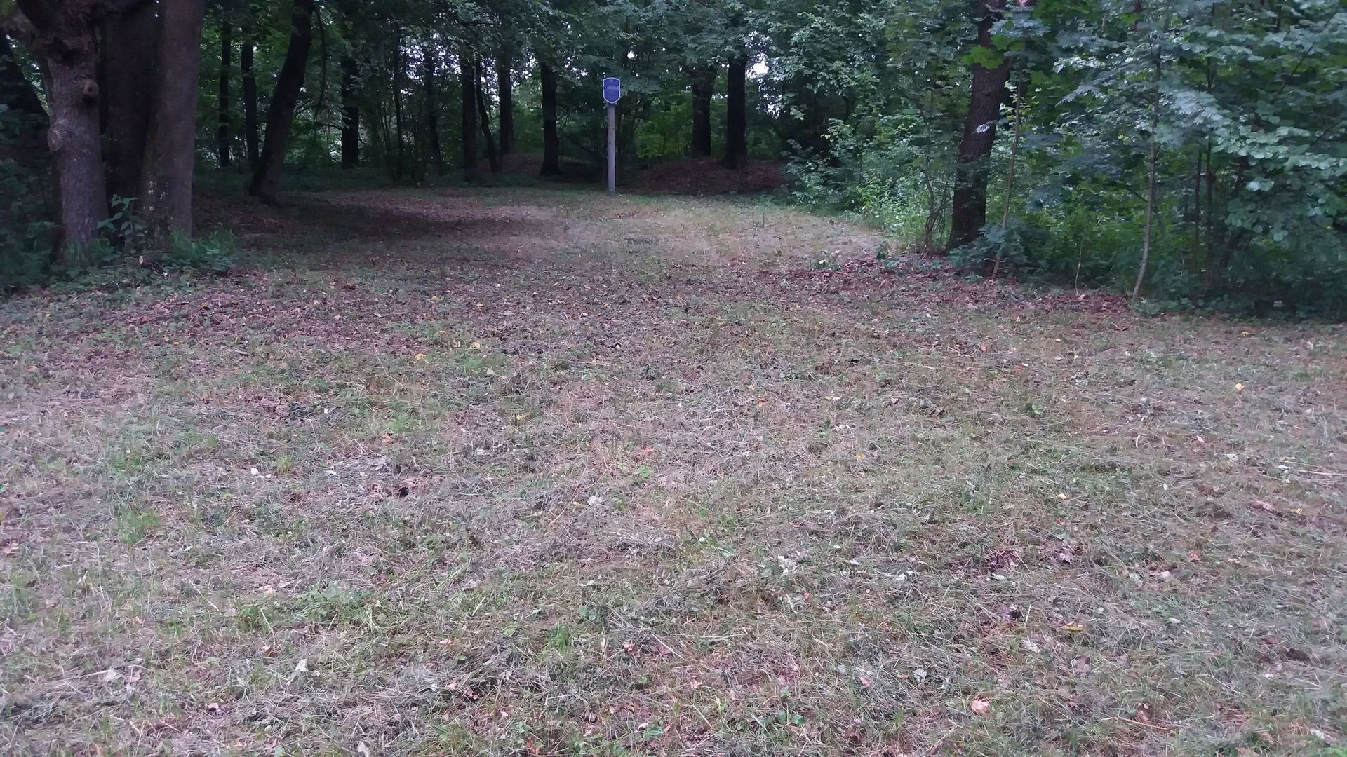
Ancient settlement of the Early Iron Age (V century BC – V century AD)
Malaya Vedren village, 2 km away Northeast of the village
|
Early Iron Age Hillfort is located 2 km northeast of the village of Mala Vedren, on the shore of the lake Wiedrenski.
The local name of the monument is "Gorodok", "Church".
Swampy floodplain of the stream complicates the entrances to the settlement, it can only be reached on foot from sides of Malaya Vedren. |
|
3 |
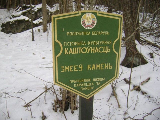
A revered stone of the Bronze Age
Gogolevka village
|
A revered stone of the Bronze Age is located near the village of Gogolevka and is a historical and cultural heritage at the district level.
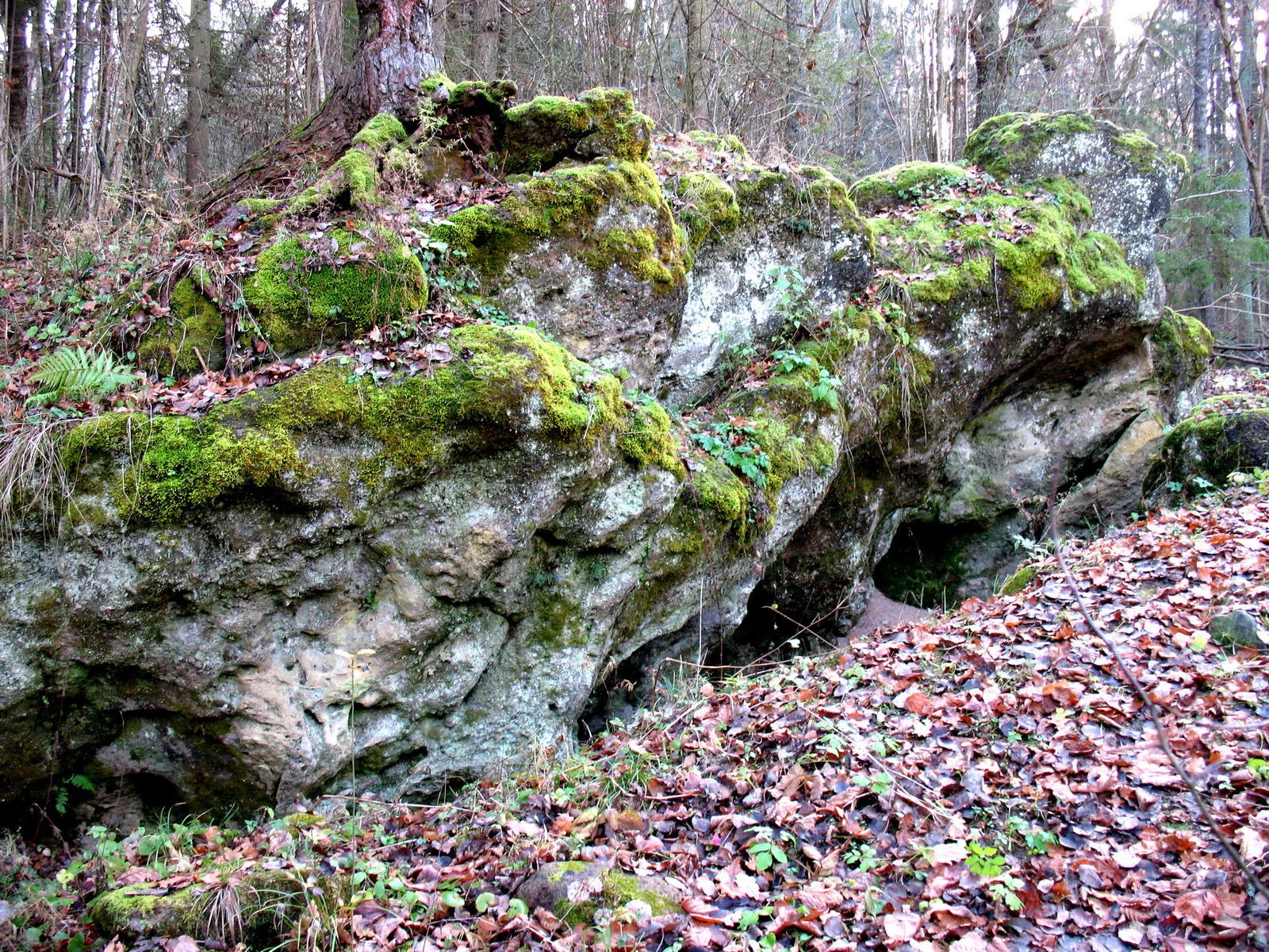
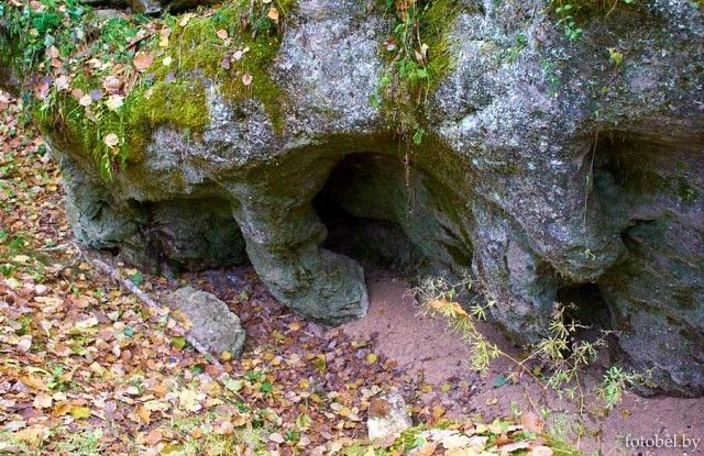
It is said that between Gogolevka and the village Virki lived a Serpent who looked like a man. And he was a good tailor. But if The customer admitted that the clothes were needed for a religious holiday, the master He deliberately made so many flaws that the cows were ashamed of such an outfit seem! And he still took the money as for a perfectly sewn thing. He is a serpent stood when he stretched out in an arc over Lake Lukoml to inspect District. And he sank to the ground already in human form. Once I saw the monster is a beauty from the village of Obuzerie and forced the girl to live with him. Relatives did not contradict: in human form, the Serpent looked like a barchuk at least Where to.
Once a girl was grazing pigs, the Serpent slept with his head on her lap. Before going to bed, he ordered to be sure wake him up when a thunderstorm begins to approach. A black one loomed over the lake cloud. But the girl decided: come what may, and did not wake up her tormentor. From The serpent woke up, hit the girl with the words: that, they say, he still lived from the light, and then flew across the lake between the villages of Gurets and Simanovichi and I went to my shelter-stone, which was five kilometers away. But From the third blow, thunder killed the monster. For three days the rain did not cease until people guessed to bury the Serpent. However, ghouls often crawled out of the ground and caused showers, until one wise old man offered to cover the reptile with earth, brought by small children.
Since then, it has become calm in the area ... The serpent stone has a completely unusual shape for our places. It reminds a sea rock in which the relentless waves washed out numerous grottoes. His Length - 12 meters, height - 4.3, width - 2 meters. At the top of the block grew A large pine tree. Someone rooted it, apparently, so as not to destroy it a serpent's dwelling, and the tree withered. |
|
4 |
Ancient settlement of the ancient city (V – VIIIcenturies)
Lukoml, on the right bank Lukomka River
|
Lukoml was in the key point on the "Way from the Varangians to the Greeks", in the interfluve of the Western Dvina and Dnieper. Archaeological excavations in the city revealed the cultural layer VIII-IX centuries, in which monuments of Scandinavian origin were found.
The ancient city was first mentioned in 1078 in connection with the confrontation between the Smolensk and Chernigov princes Vladimir Monomakh and Polotsk Prince Vseslav Bryachislavich, when Monomakh devastated Lukoml in revenge for the devastation of Vseslav of Smolensk and Novgorod-Seversky volost. When dividing the possessions of Vseslav of Polotsk The principality was allocated Lukom principality, in the era of which the city survived blossoming. In the XIV century it became part of the Grand Duchy of Lithuania, continuing to have their own appanage princes. From Lukoml leads his origin: the princely family of Lukomsky. In 1563, Lukoml during the Livonian The war of 1558-1583 was taken by storm by the Russian army and burned.
Currently presents A rectangular-elongated settlement with an area of about 0.2 hectares near the eponymous villages on the right bank of the Lukomka River. It has been repeatedly examined by archaeologists. The cultural layer (2-5 m) contains strata of different eras: Dnieper-Dvina culture, culture such as Bantserovshchina, Old Russian (XI-XIII vv.) the time and era of the Grand Duchy of Lithuania. |
|
5 |
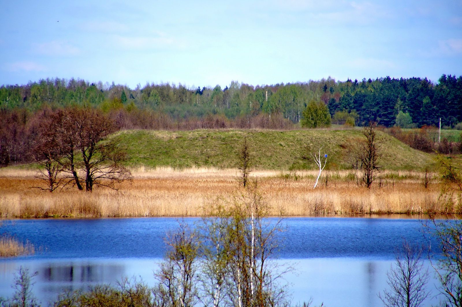
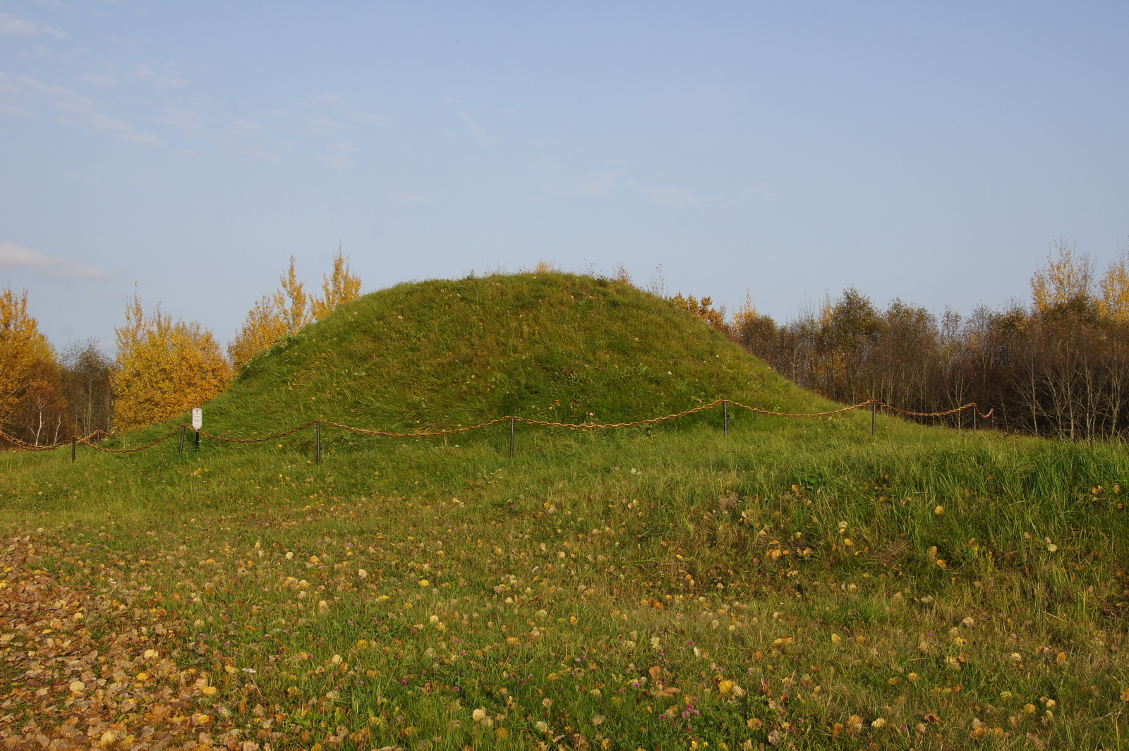
Burial mound of the early Middle Ages (IX–XIII centuries)
Przemlyansky s/s, Vaskovshchina village, 2 km southwest of the village
|
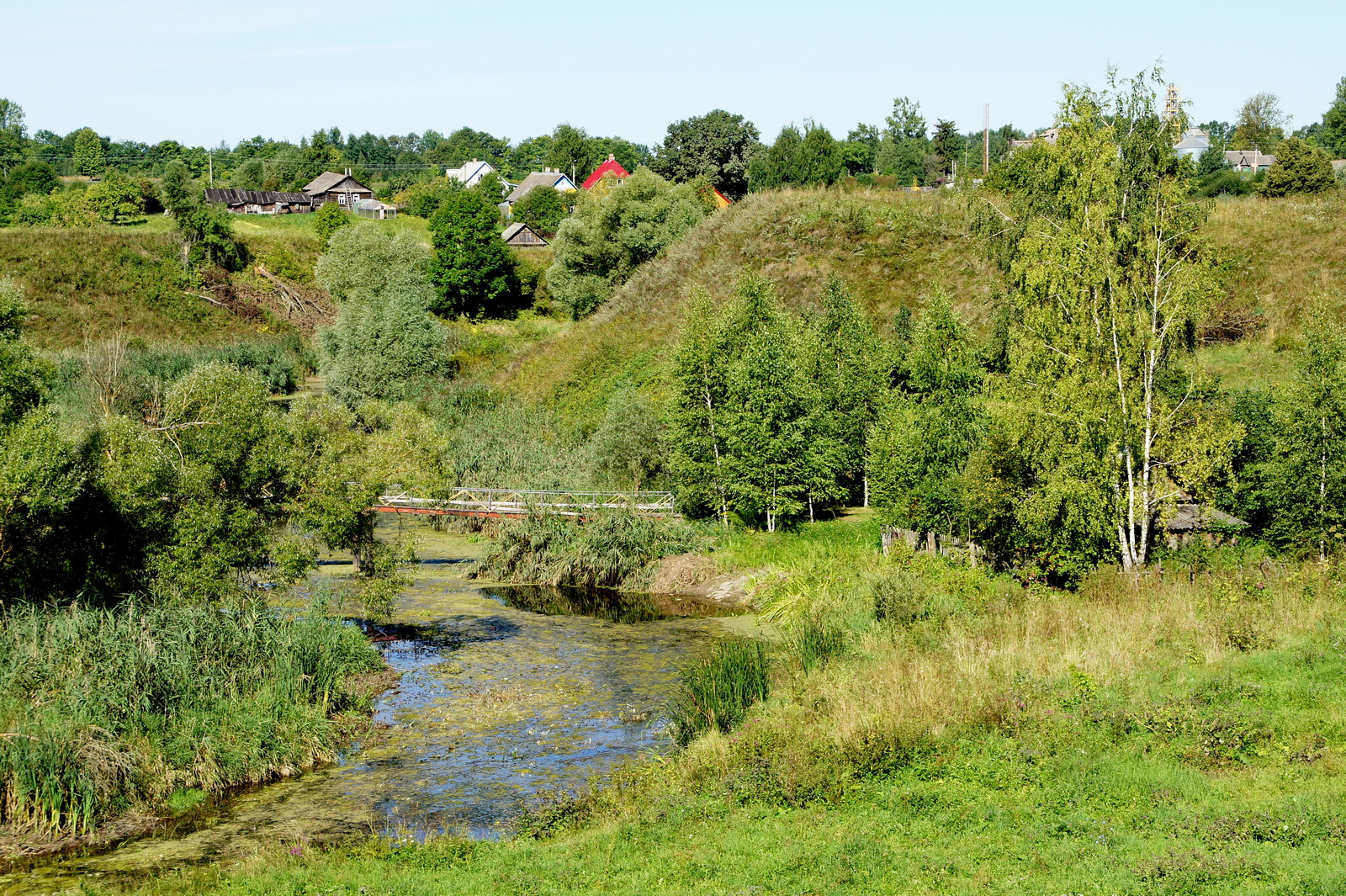
8 burial mounds 0.6–3.6 m high and 9–11 m in diameter are located on the left bank of the Ulla River. Embankment sandy, some lined with stones. Discovered in 1954 Sukhomlinova-Morozova. No excavations were carried out. |
|
6 |
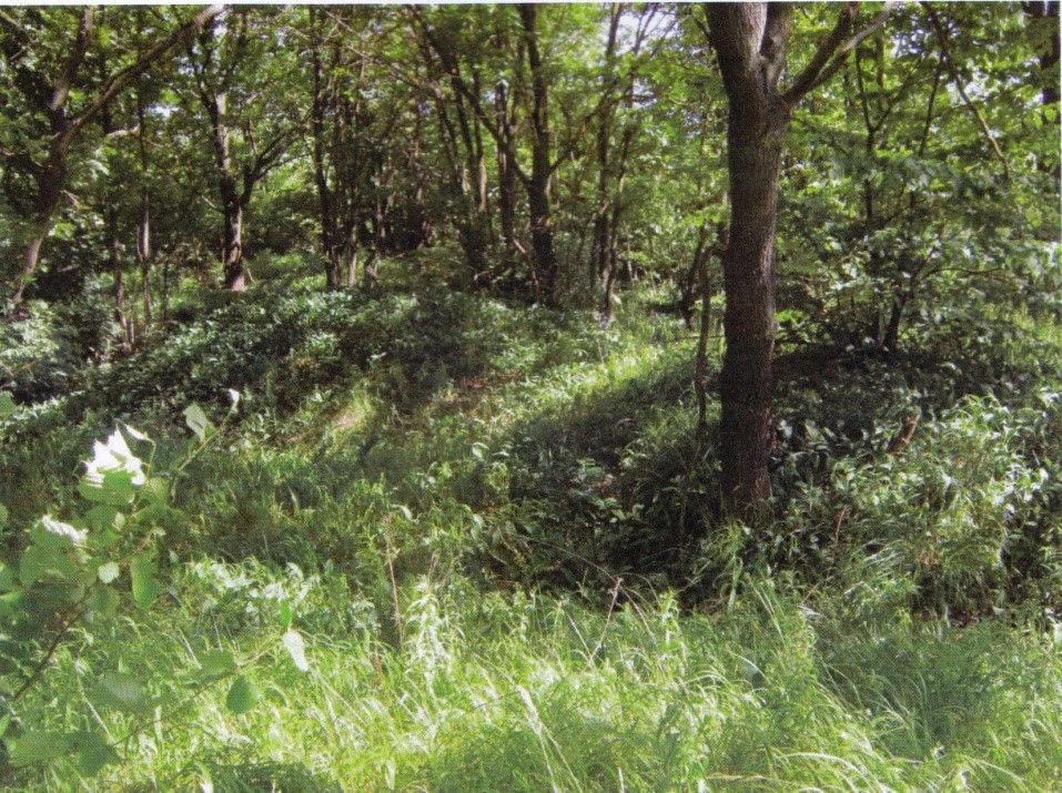
Burial mound-1 of the early Middle Ages (IX-XIIIcenturies)
Gogolevka village, 3.5 km to the east From the village |
Burial mound-1 period The early Middle Ages is located 3.5 km east of the village of Gogolevka, 1.0 km to the southeast from the village of Virka.
The mounds are arranged in three groups 3,4 and 5 embankments. The burial ground consists of 12 mounds along the road. |
|
7 |
Burial mound of the early Middle Ages (IX–XIII centuries)
Stolbtsy, 2.3 km east of Village
|
Burial mound of the period of the early Middle Ages is located 2.3 km east of the village of Stolbtsy, on the southwestern shore Lake Lukomlskoye, to the right of the Novolukoml-Stolbtsy road, adjoins to the right close to the road leading to the Sosnovy Bor dispensary.
It has the local name "Volotovka" |
|
8 |
Burial mound of the early Middle Ages (IX–XIII centuries)
Zakurie village, 1.5 km south of Village
|
Burial mound of the period of the early Middle Ages is located 0.4 - 1.6 km south of the village of Zakurie, on both sides sides of the country road to Lukoml, on the left side of the highway Chashniki-Novolukoml. The local name is "Volotovki".
The burial ground is located in groups: 3 The mounds are located in the rural cemetery, 7 mounds 0.4 km south on both side of the country road to Lukoml, group 3 - 0.15 km to the right of country road to Lukoml
|
|
9 |
Burial mound of the early Middle Ages (IX–XIII centuries)
Trilesino village, on the southern outskirts Village
|
Burial mound of the period Early Middle Ageslocated on the southern outskirts of the village of Trilesino, on the right bank of the Ulla River, on the left side of the road The burial ground has 18 mounds. |
|
10 |
Burial mound of the early Middle Ages (IX–XIII centuries)
Trukhanovichi village, 1.0 km to the north From the village
|
Burial mound of the period The early Middle Ages is located 1.0 km north of the village of Trukhanovichi, to the right of the country road road to the village of Zarechnaya, 0.5 km from the latter, 1.0 km from the intersection with dear Kruglitsa-Trukhanovichi. The burial ground has 9 mounds. |
|
11 |
Burial mound of the early Middle Ages (IX–XIII centuries)
Ag. Ivansk, 1.5 km to South-east of the agro-town
 |
Burial mound of the period of the early Middle Ages is located 1.5 km south-east of Ivansk, 0.3 km km to the right of the Ivansk-Selets road, on the left bank of the Ulla River, in the Borok tract.
The burial ground, consisting of 9 mounds, stretched along the bank of the Ulla River for 100-150 m.
The total area of the monument is 5000 sq.m, length along the bank of the Ulla River - 150-200 m, width 25 m. |
|
12 |
Burial mound -1, Kurgan burial mound -3 (IX–XIII centuries)
Slobodka village, 1.5 km west of Village
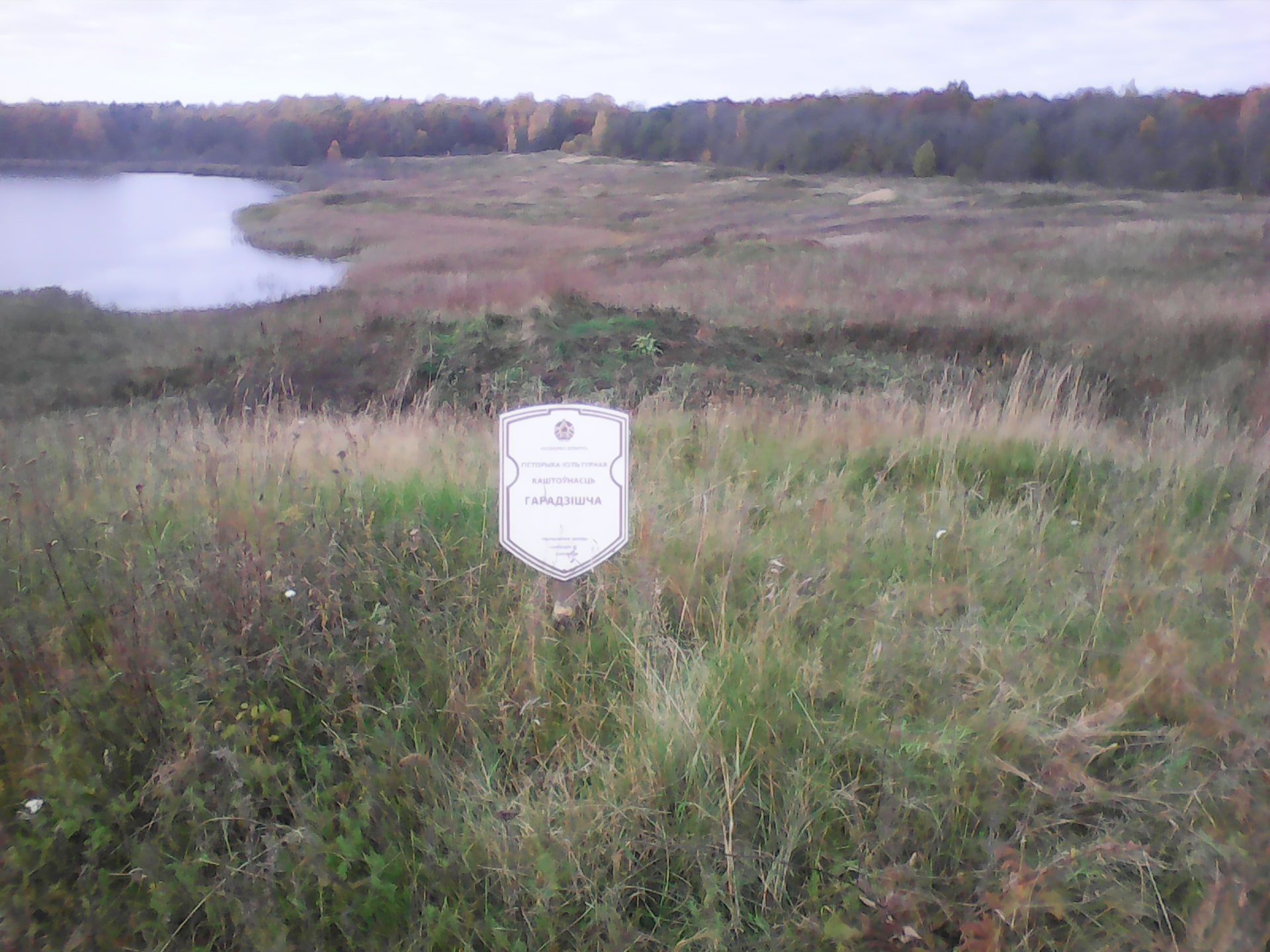 |
Kurgan burial ground -1, Kurganny burial ground -3 is located 1.5 km. to the west of the village of Slobodka, on the northern shore Lake Lukomlskoye, on the edge of the forest and in the forest on both sides of the forest road on Gurets village
|
|
13 |
Remains of the Trinity Church (X, V, I–X,V,II centuries)
Belaya Tserkva village
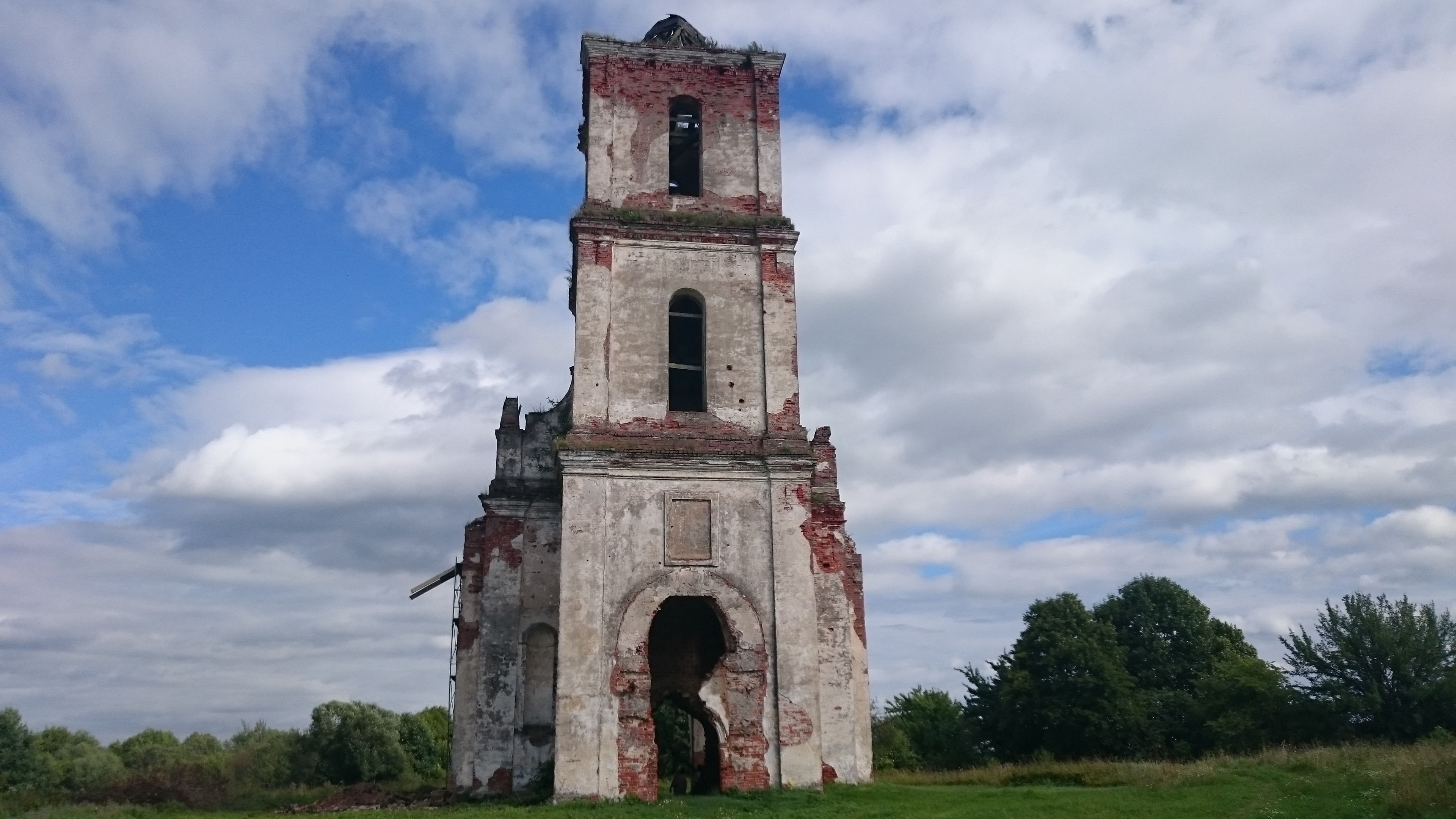 |
The remains of the Trinity Church are the most A well-known and significant landmark of the region, which is a monument of early Baroque architecture, has national significance and is assigned to the historical and cultural value of the "2" category.
The temple, located on the eastern outskirts village, on the shore of Lake Beloye (Chereyskoye), was built by Lev Sapieha in 1597-1599 together with the monastery, from the white walls of which it received the name Belotserkovsky. It consists of a tall three-tiered tower that bore defensive function, narthex, middle part of the temple and altar.
The thickness of the walls is 1.75 – 2 Meters. The window openings are narrow, semi-circular. The main volume is blocked cylindrical vault with stripping.
In the temple there was a copy of the famous image "Mother of God of the Sign", transported in 1640 by Lev Sapieha, as well as A golden shroud and a silver cross. Parents are buried in the crypt of the church Lev Sapieha.
In 1834 the monastery was closed and has been destroyed by time. At the beginning of 2014, the temple is located in ruined state. |
|
14 |
Mass grave (1941–1944) in Chashniki
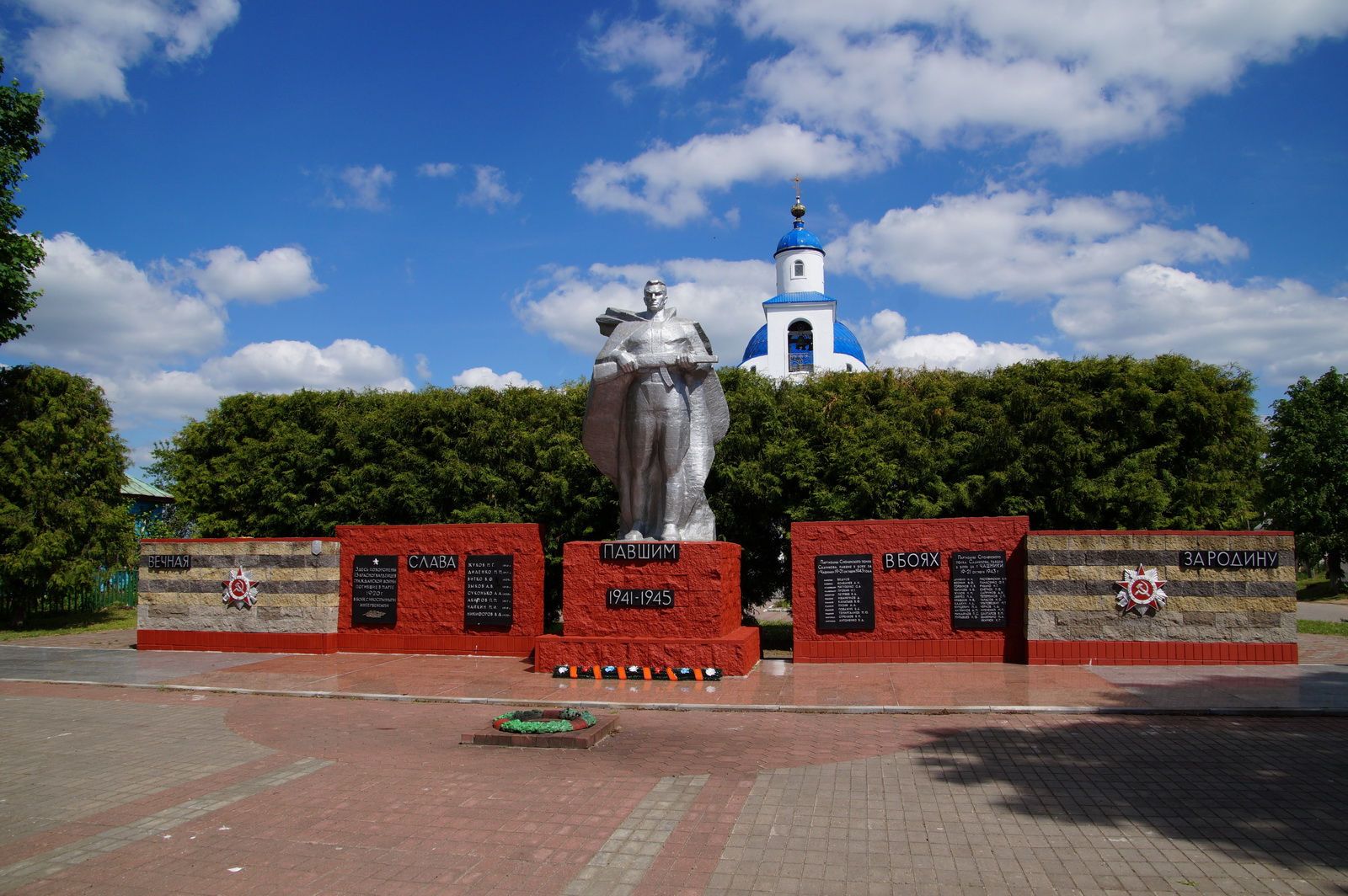
|
The mass grave (1941–1944) is located in the city of Chashniki, Sovetskaya street
The following were buried in the mass grave Red Army soldiers who died in the Civil War; Partisans who died in October 1943 during the defeat of enemy garrisons and soldiers who died in June 1944, during the liberation of the city from the Nazi invaders (total 46 people were buried).
The soldiers of the 357th are also buried here Rifle Division of the 43rd Army of the 1st Baltic Front and partisans of Chashnikskaya partisan brigade "Dubova", who died during the liberation of the city from German fascist invaders 27.06.1944 year.
In 1965, on a mass grave A monument was erected - a sculpture of a warrior. |